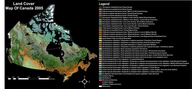
Land Cover Map of Canada 2005
MODIS Land Cover Map of Canada (LCC05) is a 250-m resolution land cover map developed by the Canadian Center for Remote Sensing. It uses multispectral MODIS imagery captured in 2005. LCC05 identifies 39 different land cover classes including forests, non‐vegetated areas (urban, water bodies, wetlands and snow/ice), shrubs, herbs, lichen and burns based on modified Federal Geographic Data Committee/Vegetation Classification Standard (Table 3). Comparison with an independent land cover product with higher spatial resolution (30m) showed 70% accuracy.